Geographic References
ASTER GDEM
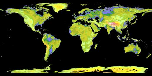
The GDEM was created by processing and stereo-correlating the 1.3 million-scene ASTER archive of optical images, covering Earth's land surface between 83 degrees North and 83 degrees South latitudes. The GDEM is produced with 30-meter (98-feet) postings, and is formatted as 23,000 one-by-one- degree tiles. The GDEM is available for download from NASA's EOS data archive and Japan's Ground Data System.
Avalanche Mapping
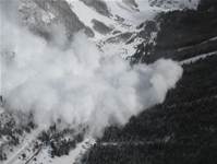
This is a project to collect digital avalanche and snowpit data promote avalanche information sharing. It is the only project dedicated to building avalanche path atlases and GIS data for avalanche modeling and forecasting.
Canadian Atlas Online
This site from Canadian Geographic hosts a variety of useful geographic materials, including thematic maps, glossary of terms, and quizzes and games for different age groups.
Esri, Inc.
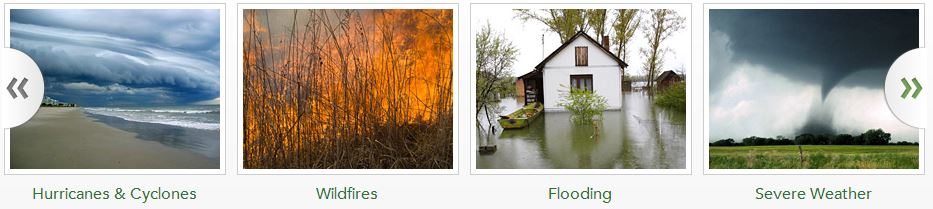
Disaster Response Resources, Esri, Inc.
GIS is used in many phases of disaster management, starting with planning before an event happens. Disaster relief involves the response phase of disaster management. GIS and GIS professionals can assist immediately by helping decision makers understand the scope of the damage and identify locations where people may be trapped or injured or require medical support and rescue. This collection Esri includes a number of maps and other resources designed to help understand Disaster Responses for wildfires, earthquakes, and other natural phenomenon.
Earth as Art
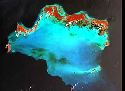
This collection, including an image of the week, uses Landsat 7 images that were taken for aesthetic rather than scientific purposes. Each of these beautiful images shows the world in a way that can only be seen from space. Also in this collection are individual Landsat images of each of the 50 states, and an amazingly different view of the journey of Lewis and Clark.
EJView
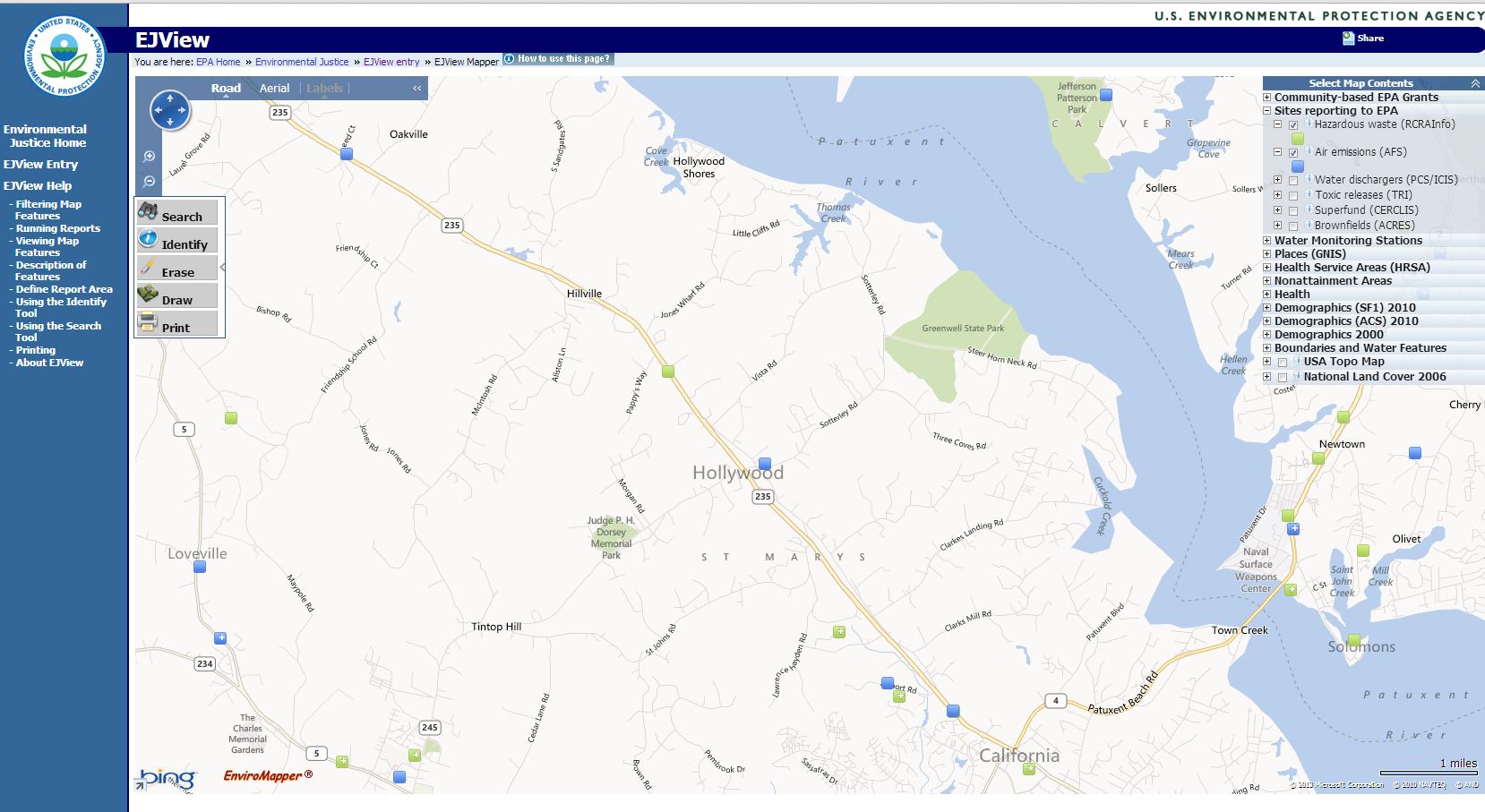
EJView, formerly known as the Environmental Justice Geographic Assessment Tool, is a mapping tool that allows users to create maps and generate detailed reports based on the geographic areas and data sets they choose.
EJView includes data from multiple factors that may affect human and environmental health within a community or region, including:
- demographic
- health
- environmental
- facility-level data
Food Environment Atlas
Food environment factors--such as store/restaurant proximity, food prices, food and nutrition assistance programs, and community characteristics--interact to influence food choices and diet quality. Research is beginning to document the complexity of these interactions, but more is needed to identify causal relationships and effective policy interventions. This collection from the USDA Economic Research service provides geospatial data useful for investigating relationships between food and proximity.
Geocube
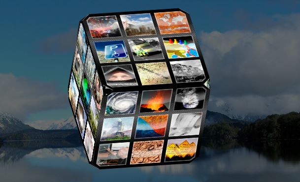
Geocube, HERODOT
The European Network for Geography in Higher Education - Geocube: re-inventing the way to explore Geography. The world of Geography at your fingertips and just a mouse click away! Geocube is an attractive online resource about Geography. Geocube is based on the principle of the Rubik Cube with six faces and 54 topics. It is a virtual and easily accessible website which is available online for free.
GSA
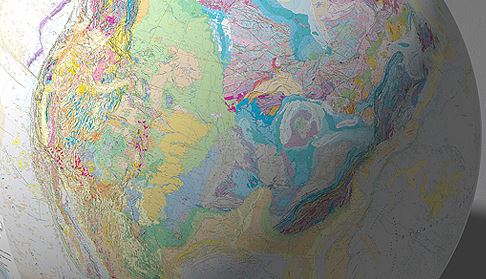
The Geological Society of America's (GSA) Geologic Map of North America (Reed and others, 2005; 1:5,000,000) shows the geology of a significantly large area of the Earth, centered on North and Central America and including the submarine geology of parts of the Atlantic and Pacific Oceans. This map is now converted to a Geographic Information System (GIS) database that contains all geologic and base-map information shown on the two printed map sheets and the accompanying explanation sheet.
Harvard Geospatial Library

Looking for layers? The Harvard Geospatial Library has TONS of data available for free to download in shapefile and other formats. Data categories range from agricultural to military to physical geography layers. This repository of GIS data is an excellent resource to use in classrooms for mapping, or to use in your own research projects.
Kanetix Travel Guide

Thanks to Alice Taylor for bringing to our attention this great cartographic reference page. Includes histories of map making and cartoraphy, rules for beginning cartographers, and guides and tools for making or using maps.
NCGE
The NCGE resources are specifically vetted and tailored toward providing outstanding content for teachers in geography. Some of the resources include data and information useful for AP Human Geography teachers, tips and tools for starting and running a geography club, integration of geography into social studies programs, and exercises for using remote sensing and GIS in your classroom.
Unique and Interesting Maps
Sometimes COGA finds some really interesting maps floating around the net! These can be of historical significance, be developed for a specific purpose, or just fun and wacky. As geographers, we love maps, and love to share them! Follow the link to see the collection of singular maps and collections.