Online Tools
Online Tools

Explore, find and log geocaches around the world. You can also get access to more tools to make geocaching even better with a Geocaching Premium membership. Use geocaching.com or the free official Geocaching apps for iPhone and Android to pick a geocache and navigate to its location. Once you find it, sign and date the logbook, re-hide the geocache exactly how you found it, and share your experience online.
The Lizard Point Quizzes website is owned by Lizard Point Consulting, a small family-run business, in southern Ontario, Canada. We have been providing free and fun educational content since 1997. We are strongly committed to maintaining the website as a family and school friendly, safe for all ages website. Your enjoyment of this site, and your privacy, are top priorities for us. A lot of people ask us how we got the name Lizard Point. Honestly, it was just a somewhat random atlas-pick; I didn't have a clue where it was, but I liked the sound of it. Geographically, Lizard Point is the most southerly point of mainland Great Britain, on the tip of the Lizard peninsula. I chose the website name in the late 1990s, but it wasn't until June 2014 that I actually visited Lizard Point!

The short version is simple. Google Lit Trips are free downloadable files that mark the journeys of characters from famous literature on the surface of Google Earth. At each location along the journey there are placemarks with pop-up windows containing a variety of resources including relevant media, thought provoking discussion starters, and links to supplementary information about "real world" references made in that particular portion of the story.
Graphic Organizers
Graphic Organizers, Mind Maps and Concept Maps are pictorial or graphical ways to organize information and thoughts for understanding, remembering, or writing about. Graphic organizers, mind maps and concept maps are powerful tools that can be used to enhance learning and create a foundation for learning.

Here at ReadWriteThink, our mission is to provide educators, parents, and afterschool professionals with access to the highest quality practices in reading and language arts instruction by offering the very best in free materials.

Education World is a complete online resource that teachers, administrators and school staff can visit each day to find high-quality and in-depth original content. The Education World team, including a network of skilled content providers, have maintained this free resource for educators since 1996. In order to keep the site free, Education World is funded by corporate sponsors and advertisers. The site is also part of The Educator's Network, which simplifies educator-targeted media buying and offers efficient, optimized campaigns across multiple teacher sites via a single point of contact.

After four decades of fly-by probes, orbiters, landers, and rovers, the quest for life on Mars is as tantalizing as ever. NOVA goes behind the scenes of the latest NASA missions to the Red Planet to reveal new clues and challenges on the road to answering this ultimate question. With unique access to the NASA Phoenix and Mars Exploration Rover missions, NOVA shows scientists and engineers in action, directing the operations of spacecraft millions of miles away, as the robotic explorers drill into rock, claw into soil, analyze samples, and trundle across the rock-strewn landscape in search of signs that Mars once or maybe even still harbors some form of life.

Life around the world is changing rapidly - here you find the data visualizations that show you how. Our World In Data covers a wide range of topics and visualizes the empirical evidence of how living standards changed over the last decades, centuries, and millennia.
Owl and Mouse Educational Software

Scientific Method: Understanding How Science Works
The mission of Understanding Science is to provide a fun, accessible, and free resource that accurately communicates what science is and how it really works. The process of science is exciting, but standard explanations often miss its dynamic nature. Science affects us all everyday, but people often feel cut off from science. Science is an intensely human endeavor, but many portrayals gloss over the passion, curiosity, and even rivalries and pitfalls that characterize all human ventures. Understanding Science gives users an inside look at the general principles, methods, and motivations that underlie all of science.
Seterra – Learn Geography Software
Seterra is a challenging educational geography game with more than 100 different exercises. Learn about countries, capitals, oceans, flags and cities in Africa, Europe, South America, North America, Asia and Australia, using outline map exercises! Seterra has been around since 1998, is translated into 26 different languages and has been loved by people all around the world.

Sheppard Software: World and U.S. Geography Games
At our site, we have hundreds of free, online, educational games for kids. But anyone interested in online learning can use our site - we have so many subjects - (geography, math, animals, science) and many levels, games and activities for learners of any age.
The Veterans History Project of the American Folklife Center collects, preserves, and makes accessible the personal accounts of American war veterans so that future generations may hear directly from veterans and better understand the realities of war.
![]()
![]()
Tourality - The Ultimate Outdoor Location-Based Game
Tourality, as a location based game (LBG), is a novel kind of game. Your real environment such as a urban district, some park or even a wood serve as a virtual playground, where your location and movements are identified via GPS-signal emitted from your cell- or smartphone. Your target is to reach certain predefined spots in the game set by moving towards them with your mobile device.
Walk Score is available for any address in the United States, Canada, and Australia. We've also ranked the largest 3,000 cities and over 10,000 neighborhoods so you can find a walkable home or apartment. We believe that walkable neighborhoods with access to public transit, better commutes, and proximity to the people and places you love are the key to a happier, healthier and more sustainable lifestyle.

Trends in International Mathematics and Science Study - Resources from multiple countries
![]()
Virtual Pilot

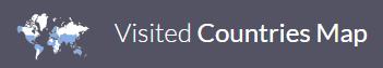
Produce a map of the world with countries you have visited
Teachers and librarians can confidently encourage students to use Funbrain during their free time in class, assured that kids will enjoy an educational, safe online learning experience. Funbrain's games help students build on what they have learned in class and acquire new skills in reading, math, and problem solving.
Today we welcome the newest member of the Library's blog family. World's Revealed: Geography & Maps at the Library of Congress will highlight cartographic objects from the Library's collections that "sometimes go beyond what usually ends up in exhibits and in textbooks and bring to the forefront uncatalogued objects that have never before been placed online."